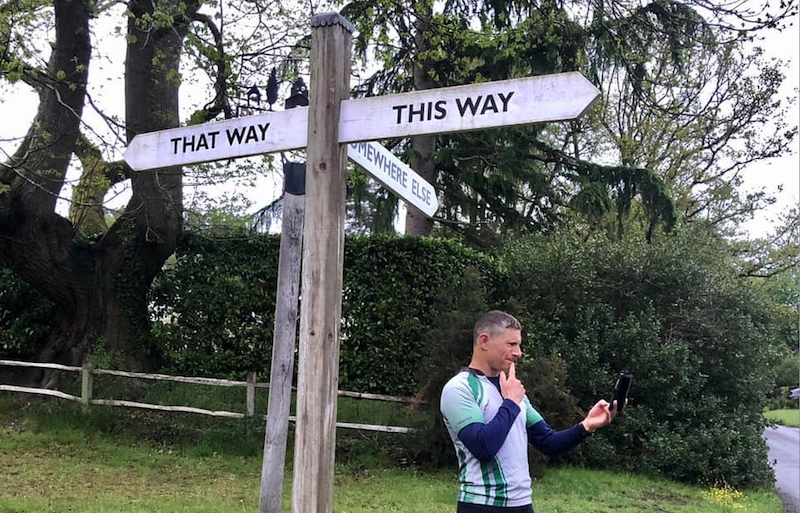
Planning a new trail running route is simpler than you think and will bring big benefits
If you are a person who can run the same route week in week out, congratulations because you have got a whole lot more patience than I have.
I feel a strong pull towards following barely discernible animal tracks (known as a spoor) and regularly head off into the woods to find a strange ruin or the like. Not a day goes by without me looking at a map to come up with a new place to discover or a new route to try. When I am in a car, I have an eye out for footpath finger posts making a mental note to look up where they lead later on.
Some might say it is an obsession but I absolutely love route planning aka exploring. And it has huge benefits to us as trail runners and walkers, including:
- Keeping you motivated. Running is so much about the head. Keep that engaged and the running follows. If you have lost your running mojo chances are it is because you don’t have enough interest going on in your runs.
- Encouraging your body to get stronger as it has to adapt to new stresses. Run the same route and you will get really good at that route. To get better you need new challenge.
- Helping you develop new techniques for different terrains
- Connecting you to a landscape and to the place you live.
- Keeping you curious and learning.
- Helping you improve your navigation. The more you do new routes the more confident you will get
- Expanding your running area hugely.
There is no right or wrong way to plan a trail running route and there are lots of apps out there that will give you suggestions from other people (Komoot, All Trails, OS Maps, Strava etc) but if you fancy coming up with your own, try this,
- Keep an eye for footpath signs on the side of the road and look them up later
- Look at map of the area, look at the green spaces, areas which will likely have more trail runs.
- Be curious, see places mentioned in the news, online, word of mouth and use them to centre a run around.
- Find a point to start from (often a café in my case) and then work out a route to loop round from it
- Find a point to point with a means of getting back to the start and working out a route. Taking a train and running back is a great option. see our Train to Trail runs.
- Search for possible routes in National Trust areas or National Parks etc
But what all these need, is a MAP but not just any old map.
You need a map that shows footpaths and bridleways (green dotted or dashed lines on Ordnance Survey Maps) as these are the routes that you can legally run along.) There are areas which are deemed Access Land areas and means you don’t need to stick to footpaths and that means your navigation skills need to be stronger. The UK is blanketed with paths and that means your run possibilities are endless. Google maps or similar are not good enough if you are planning on running off road.
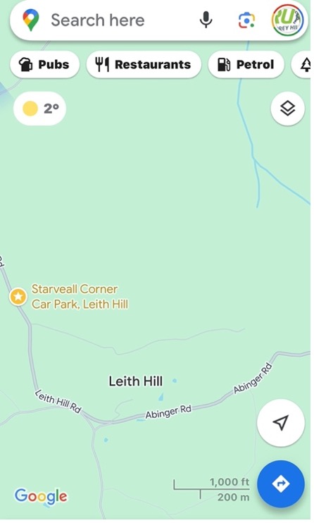
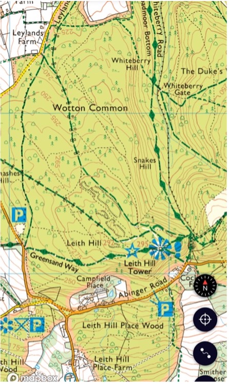
Compare google maps and ordnance survey map of the same area of Leith Hill, Surrey above to see the difference.
There are lots of different types of maps you can use depending on the size at which they are drawn in (scale), area covered and map maker. Take a look below to see 2 different maps of the same area.
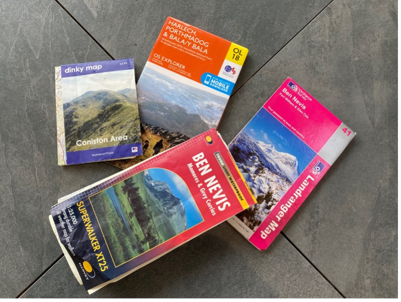
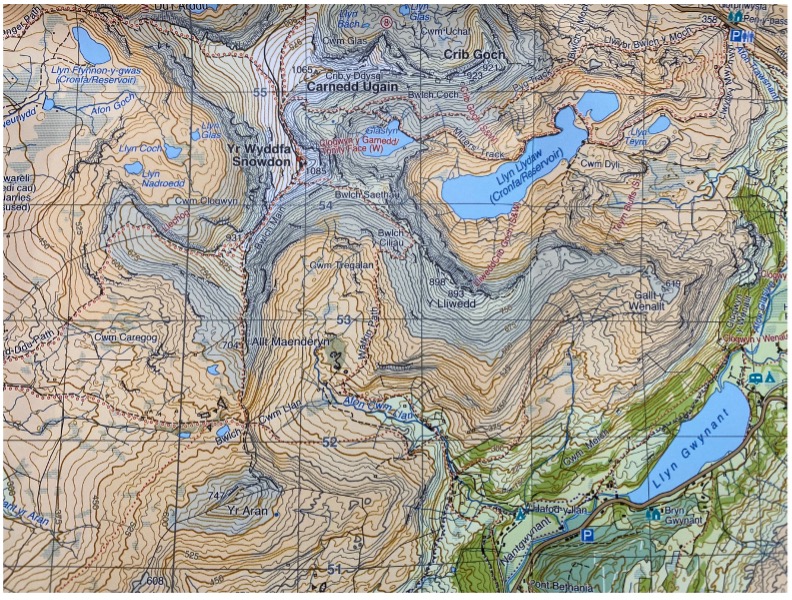
Different types of maps A Harvey map of Yr Wyddfa (Snowdon) 1:40000
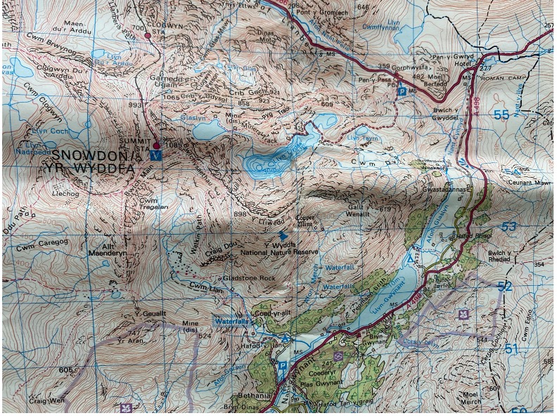
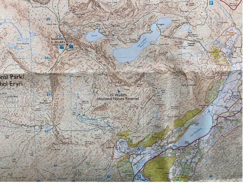
An OS map of Yr Wyddfa 1:50000 An OS map of Yr Wyddfa 1:25000
Get started by spending some time planning
- Think about how far you want to go on your trail running adventure
- Look at the ground detail. It is easy to think ‘I will go 10km and that will take me an hour’ and not factor in there is 1000m of running uphill or really muddy ground which will take longer.
- Give yourself extra time to run a new route. Stressing that you are not back to meet the delivery guy does not a fun run make.
- Have a go, plot a potential route. Adjust if not long enough, too long etc.
- Keep it simple. A complicated route may look cool on your app but it can be a headache to follow in reality.
I am a big fan of the OS Maps app (costs £39.99 a year and includes every map in the UK and you can print them off, plot routes, track routes and more). It is straightforward to plot a route on the app and it will give you distance and estimate the time it will take. I will plot a route at home and then check on my phone where I am on the route when I am out running or walking. I often use a paper map too and many people download a route to their watch. It is personal preference.
There are lots of other software that you can do this on but remember if you planning on running trail you need to make sure the ‘map’ you are using shows footpaths, bridleways and not just roads. And ideally some features of the area so that they can help orientate you. The number of people I spot lost on Leith Hill using google maps is worrying.
Do a reality check. Whereas following someone else’s route is great in reality it may not be the best. There have been some serious incidents where people have blindly followed a route in The Lake District and found themselves having to call mountain rescue because the route took them down a cliff.
But what if I get lost?
- If you are using an app or watch to track the route use it to go back the way you came. Most will have some sort of point on the screen to show where you are.
- Sit down, calm down. Ok maybe not sit but the point is take a few breaths to get the rational bit of your brain working. Unless you are in the mountains or vast open areas like the Peaks or Dartmoor, you will not be far from a road. You can retrace your steps, ask someone.
- Often going down the wrong path can lead to the discovery of a new route so it can be a great opportunity and add another piece to the map you hold inside your head.
Planning a group trail run.
If you find yourself designated run leader for your running mates then
- Work out what the group wants from the run. There is no point planning an offroad epic if you have a road runner whose favourite distance is 10km
- Remember it is a group run, so that means sticking together and going at the pace of the slowest runner on the day.
- Think about what you might need to take with you and what you want others to bring e.g. if it is going to be a long day out then a first aid kit, a waterproof jacket, food and drink
- Check the forecast and be prepared to change your run or at least put that waterproof phone case on.
- Plan a route that has some ‘outs’ if people want to stop early and get back to the start.
- Be confident that you have some way of following your route either on your phone, on your watch or an old school map
And finally...
The key to it all, is to have a go. Get stuck in, make a route and go and run or walk it. You never know what is around the corner until you look.
If new routes are really not your thing or you want to build up your confidence and skills come along to a guided run or walk or join one of our Navigations Skills courses. Click here
#getoutside #guidedrun
